





TL;DR: GPS tracking app development at a glance
GPS tracking app development is the process of building software that collects location fixes from a smartphone or a hardware tracker, transmits them to a server, and turns a stream of raw coordinates into something a person can act on: a live map, a geofence alert, a delivery ETA, a driver behaviour report, a proof of visit. The category covers fleet management platforms, courier and last mile delivery apps, field workforce tracking, personal safety products, asset and container tracking, and pet or child locators. A working MVP with live tracking, geofencing, trip history and an admin dashboard typically costs between USD 25,000 and 45,000 and takes three to four months, while a multi tenant commercial platform with IoT device support, analytics and billing usually lands between USD 90,000 and 250,000 depending on how much of the hardware side you own. The technical work is rarely the hard part. What separates a product that survives contact with real users from one that gets uninstalled in a week is battery discipline, honest handling of Android and iOS background location restrictions, defensible consent flows, and a data model that does not collapse when ten thousand devices each report a position every five seconds.
Three constraints shape every decision in this category. Location accuracy degrades badly in cities and indoors, so the product has to degrade gracefully too. Continuous tracking drains batteries, so sampling has to adapt to context rather than run at a fixed interval. And location data is regulated almost everywhere, which means consent, retention limits and access controls are product requirements rather than legal afterthoughts. Build the MVP around one tracking use case, prove the accuracy and battery numbers on real devices in the actual operating environment, then expand. Aalpha builds GPS tracking and telematics products across fleet, delivery, field workforce and IoT asset tracking, covering the mobile client, the real time backend and the operator dashboard as one engagement.
What is a GPS tracking app?
A GPS tracking app is an application that determines where a person, vehicle, or object is, records that position over time, and makes the record available to someone with a reason to see it. The definition sounds simple. The engineering underneath it is a pipeline: a receiver acquires a fix from satellites, the operating system fuses that fix with Wi-Fi, cell tower and sensor data to improve it, the app decides whether the fix is worth sending, a transport layer moves it to a server, and a backend stores, filters and broadcasts it to whoever is watching.
The satellite side is worth understanding because it explains most of the failure modes. GPS is one of several global navigation satellite systems, alongside GLONASS, Galileo, BeiDou, and regional systems like NavIC and QZSS. Modern phone chipsets receive several of these at once, which is why “GNSS” is the technically correct term even though everyone says GPS. A receiver needs signals from at least four satellites to solve for latitude, longitude, altitude and clock offset. Fewer satellites, or satellites clustered in one part of the sky, produces a worse geometry and a worse fix.
GPS tracking apps compared with navigation apps
Navigation apps answer a question for the person holding the phone: how do I get from here to there. Tracking apps answer a question for somebody else, usually asynchronously: where is this thing now, where has it been, and did it do what it was supposed to. That difference drives everything. Navigation runs in the foreground for the length of a trip with the screen on and the user watching. Tracking runs in the background, often for hours, frequently with the screen off, and has to survive the operating system’s attempts to suspend it. A navigation app that uses 20 percent of the battery over a two hour drive is acceptable. A workforce tracking app that uses 20 percent over a two hour shift will be uninstalled or force stopped by the end of the week.
Real time and periodic tracking
Real time tracking pushes each new position to the server and onward to any connected viewer within a second or two, which is what a dispatcher watching a live map or a customer watching a courier approach expects. Periodic tracking collects fixes locally and uploads them in batches every few minutes, which is enough for timesheets, route reconstruction, proof of delivery and most compliance reporting. Batched uploads cost a fraction of the battery and a fraction of the server load. A surprising number of products specify real time tracking, build the infrastructure for it, and then discover that nobody actually watches the live map outside of exceptions. Ask what someone will do differently with a two second update versus a two minute one. If there is no answer, batch it.
Active and passive tracking
Active tracking transmits as it goes and needs connectivity. Passive tracking, sometimes called data logging, stores fixes on the device and offloads them later, either on reconnection or physically. Passive designs still matter in mining, shipping, agriculture and long haul freight where coverage is unreliable. The practical answer for most products is a hybrid: log everything locally to a queue, transmit when the network allows, reconcile on the server by timestamp rather than arrival order.
Components of a GPS tracking system
A production system has five moving parts. The tracking client is either a mobile app or a dedicated hardware unit such as an OBD II dongle, a hardwired vehicle tracker, or a battery powered asset tag on NB IoT or LoRaWAN. The ingestion layer accepts positions over MQTT, WebSocket or HTTP and validates them. The backend stores the stream, evaluates geofences and alert rules, and exposes APIs. The mapping and routing provider supplies tiles, geocoding, directions and map matching. The presentation layer is a web dashboard for the operator and a mobile view for the tracked user or the end customer.
Who uses GPS tracking software
Logistics operators and courier companies form the largest commercial segment, followed by field service organisations, construction and equipment rental firms, public transport authorities, insurance companies running telematics programmes, and healthcare providers coordinating home visits. On the consumer side, family locators, pet trackers, personal safety apps and fitness trackers dominate. The technology is the same. The regulatory posture, the accuracy tolerance and the willingness to pay differ enormously.
Types of GPS tracking applications
The category is broad enough that “GPS tracking app” describes a dozen different products with different economics. Deciding which one you are building is the first scoping decision, because it determines whether your hard problem is battery life, accuracy, scale, hardware integration or consent.
Personal and family locators let members of a group share position with each other, usually with arrival and departure notifications for home, school and work. The engineering challenge is battery drain on a personal phone that the user did not buy for this purpose, and the commercial challenge is that the market leaders are entrenched and free at the entry tier. Consent design matters more here than anywhere else outside the workplace.
Fleet and commercial vehicle tracking is the deepest market. These systems combine hardware trackers with a dispatcher dashboard, and their value comes less from the dot on the map than from what surrounds it: fuel reporting, harsh braking and acceleration events, driver scorecards, maintenance scheduling, and hours of service compliance. Vehicle installed hardware removes the battery problem entirely and gives access to engine data through the OBD II or CAN bus, which is why serious fleet products almost always ship hardware rather than relying on driver phones.
Delivery and courier tracking splits into two audiences from one location stream. The dispatcher needs assignment, route sequencing and exception handling. The customer needs a shareable link with a moving marker and an ETA that does not embarrass you. Getting the ETA right is harder than the tracking, since it depends on live traffic, stop duration and how many drops sit ahead in the sequence. Businesses that want this capability without a ground up build sometimes start from a white label platform such as DeliveryStack and customise the parts that differentiate them, which shortens time to market considerably when the operating model is standard.
Employee and field workforce tracking covers technicians, sales reps, home health workers and inspectors. Location here is usually a means to an end: proving a visit happened, timestamping arrival, dispatching the nearest available person. These products live or die on consent and transparency. Track only during shift hours, show the worker exactly what is being recorded, and let them see their own data. Anything else produces grievances, works council disputes in parts of Europe, and quiet sabotage such as leaving the phone in the van.
Asset and equipment tracking applies to trailers, containers, generators, tools, and pallets. Fixes are infrequent, sometimes once or twice a day, and battery life is measured in months or years rather than hours. This is IoT territory, not smartphone territory: LTE-M, NB IoT and LoRaWAN modules with power budgets that rule out continuous GNSS. Bluetooth tags with crowd sourced finding networks cover the low value end.
Public transport tracking feeds arrival predictions to riders and headway management to operators. Data volume is predictable but the accuracy expectations are high, and the interesting engineering is in map matching a bus to a known route and predicting arrival at the next twelve stops rather than in the tracking itself.
Emergency and personal safety apps add an SOS trigger, escalation to contacts or a monitoring centre, and continuous location sharing during an incident. Reliability requirements are unlike anything else in the category. If a panic button fails once, the product is finished.
Fitness and outdoor activity trackers need high frequency sampling, accurate distance and elevation, and route rendering, but they only run during an activity. That bounded session makes the battery problem tractable and lets you sample at 1 Hz without complaint.
Pet and livestock tracking pairs a collar device with a phone app and a safe zone. Consumer pet trackers compete on collar size, battery life and subscription price. Livestock systems care about herd level movement patterns and often run on LoRaWAN across a ranch.
Location based social and dating apps use proximity rather than precision, and typically fuzz coordinates deliberately before storing or exposing them.
Geofence attendance apps replace physical punch clocks with location verified check in at a site. The whole product rests on spoofing resistance, since the incentive to fake a location is direct and financial.
Beyond these, industry specific systems combine tracking with domain logic: cold chain platforms pair position with temperature telemetry, waste collection systems verify bin service against a route, and rental scooter operators tie tracking to remote lock control and parking zone enforcement.
How GPS tracking benefits a business
The business case for tracking is usually made in vague terms and then defended with specifics after deployment. It is better to identify the specific line item you intend to move before you write any code.
Visibility replaces phone calls. In dispatch operations without tracking, a coordinator spends a large part of the day asking drivers where they are. That time is recoverable and it is the easiest saving to measure, because you can count the calls before and after.
Routing and dispatch get faster. Knowing which unit is closest to a new job, and assigning it without a conversation, compresses response time. Sequencing multiple stops against live traffic reduces distance driven per job.
Fuel and vehicle costs fall, mainly through less idling, fewer unauthorised trips and shorter routes. The idling number surprises operators most often. Once drivers know engine idle time is recorded, it drops before anyone is disciplined.
Accountability improves without micromanagement, provided the system reports facts rather than suspicions. Timestamped arrival and departure at a customer site settles disputes in both directions, which is why some field workers come to prefer having it.
Assets get used more evenly. Equipment rental and construction firms routinely discover machines sitting idle on one site while another site hires in a replacement. Utilisation reporting pays for the tracking hardware on its own.
ETAs stop being guesses. Accurate arrival predictions cut inbound “where is my order” contacts sharply, and the reduction in support load is straightforward to quantify.
Theft recovery becomes possible. Concealed trackers on plant, trailers and high value cargo recover assets that would otherwise be written off. Insurers sometimes discount premiums for fitted telematics, which is worth checking before you price the project.
Attendance and proof of service become automatic. Geofenced check in removes manual timesheets and produces an evidence trail for billing, which matters in home care, security patrol and any contract paid by verified visit.
Historical routes support analysis that live tracking cannot. Replaying three months of routes reveals structural waste: territories that overlap, depots in the wrong place, customers who always take longer than the schedule allows.
Customers get better information, and a shareable tracking link with an accurate ETA has become a baseline expectation in delivery rather than a differentiator.
Planning improves once the data accumulates. Real travel times between real locations beat planning assumptions, and the gap between the two is often where the margin went.
New revenue becomes available for firms that already own the location stream. Usage based insurance, per verified visit billing, delivery as a service for other merchants and paid customer visibility tiers are all built on top of tracking that already exists.
Core features of a GPS tracking app
Feature lists in this category tend to be copied between competitors until every product claims the same forty capabilities. The list below is organised by who uses each feature, which is more useful when you are deciding what belongs in a first release.
Features for the tracked user and the end customer
Registration and login should support the reality that many tracked users never chose to install the app. Field workers are enrolled by an administrator, drivers receive credentials with a vehicle, and family members join by invitation. Support invitation based onboarding and single sign on for enterprise deployments rather than assuming self service signup.
Live location on a map is the visible core: the user’s own position, other members of their group, or the vehicle they are responsible for. The map needs clustering when marker counts rise, smooth interpolation between fixes so the marker glides rather than jumps, and a clear indicator when a position is stale.
Location sharing on a time limited link is one of the highest value features in consumer and delivery products. Share for one hour, share until I arrive, share with this person only. Time limits should be enforced server side and the link should expire on its own.
Route display and turn by turn navigation are often better handed to Google Maps or Apple Maps through a deep link than rebuilt in your app. Building navigation properly is a project in itself, and users generally prefer the app they already trust for driving directions.
ETA display needs live traffic to be credible. A straight line distance divided by an average speed will be wrong often enough to destroy confidence in the number.
Geofence creation lets users define zones by drawing a circle or a polygon, with entry and exit notifications attached. Radius should have a sensible floor, since a fifty metre geofence in a dense urban area will trigger and untrigger repeatedly as accuracy fluctuates.
Trip and location history gives a scrollable timeline with a replay of each route, distances, stop durations and start and end times. Retention here is a policy decision, not a technical one.
An SOS or emergency control belongs in personal safety, lone worker and family products. It should work from the lock screen or a hardware button combination, escalate through a defined chain, and share continuous location for the duration of the incident.
Offline maps and offline queuing keep the app useful where coverage fails. Cache tiles for the working area and hold unsent positions in a local queue with a durable write, not just in memory.
Battery and connectivity indicators, and a visible tracking status, prevent the most common support ticket in this category: nobody can tell whether tracking is actually running. Show it plainly.
Privacy controls give the tracked person a pause button, a way to see exactly what is recorded about them, and a way to leave. In workforce products, automatic tracking cut off outside shift hours does more for adoption than any feature you could add.
Features for administrators and operators
The dashboard is where the product is judged by the buyer. It shows all active units on one map with filters, status counts, and a jump to any unit’s detail view. Performance matters: rendering two thousand live markers in a browser without a canvas or WebGL layer will not work.
Entity management covers users, vehicles, devices and assets, with the relationships between them. A driver changes vehicles, a tracker gets moved between trailers, an asset is assigned to a site. Model these as time bounded assignments from the start, because retrofitting history onto a simple foreign key is painful.
Role based access control is not optional in any B2B deployment. A regional manager sees their region. A dispatcher sees today. An auditor sees history but cannot change anything. Location data with no access control inside the company is a breach waiting for a trigger.
Dispatch and route assignment tools push jobs to units, sequence multiple stops, and re optimise when something changes. Serious route optimisation with time windows, capacities and driver constraints is a specialist problem, and using an established optimisation service is usually cheaper than building a solver.
Geofence management at scale needs bulk import, categories, and rules attached to zones rather than to individual units. A logistics customer with four hundred delivery zones will not draw them one at a time.
Alerting covers speeding, extended idling, route deviation, unauthorised movement outside working hours, prolonged stops, low device battery, and tracker disconnection. Every alert needs a threshold, a cooldown and a mute, or the operator will start ignoring all of them within a fortnight.
Driver behaviour monitoring derives harsh braking, rapid acceleration, cornering and speeding events from accelerometer and position data, then rolls them into a score. Be careful how the score is presented. Scores that punish drivers for traffic conditions they did not control generate resistance quickly.
Reporting covers distance, time on site, stop analysis, utilisation, fuel and exceptions, with scheduled email delivery and export to CSV or Excel. Export is a feature buyers check for during evaluation, so do not defer it.
Billing and subscription management belongs in the product if you are selling a SaaS platform: per device pricing, plan tiers, proration and dunning.
An API with webhooks decides whether your product becomes part of a customer’s operation or stays a separate screen. Publish a REST API for entities and history, a webhook for events, and be explicit about rate limits.
Audit logs record who viewed whose location and when. This one line item resolves internal misuse allegations and satisfies data protection reviewers, and it costs almost nothing to add early.
Advanced capabilities worth planning for
Machine learning has a few genuine uses here, along with a great deal of marketing. Predicted arrival times trained on your own historical trips consistently beat generic routing engine estimates, because they learn that a particular customer’s loading bay takes twenty five minutes and that a specific corridor is slow on Thursdays. Anomaly detection flags routes that deviate from the pattern for a given driver and shift rather than from a fixed rule. Predictive maintenance from engine diagnostics and mileage has real value in fleets, but it needs OBD or CAN data, not just position.
Indoor positioning through Bluetooth beacons, ultra wideband or Wi-Fi fingerprinting fills the gap where GNSS cannot reach, which matters in warehouses, hospitals and large facilities. Voice guidance, augmented reality walking directions and satellite messaging integration are niche additions that justify themselves in specific products and nowhere else.
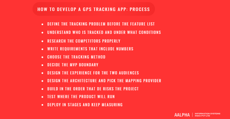
How to develop a GPS tracking app: a step by step process
-
Define the tracking problem before the feature list
Start from the operational decision the tracking is supposed to change. “Reduce time from job creation to technician arrival” produces a different product than “prove our security guards completed their patrol”. Write the decision down, name the metric, and hold the feature list against it.
-
Understand who is tracked and under what conditions
Identify the tracked party and their incentive. A parent installing a family locator behaves nothing like a driver required to carry a company phone. Then document the operating environment, because it dictates the hard technical constraints: dense city, rural coverage gaps, underground parking, indoor warehouse, cross border travel. Ask which devices are involved, how old they are, whether they are personal or issued, and what happens when the battery dies mid shift.
-
Research the competitors properly
Install three or four competing products and run them for a week on real routes. This is faster than reading feature comparison pages and it surfaces things no marketing page admits: how the app behaves after the phone reboots, whether it recovers from a killed process, how it handles a fifteen minute tunnel. Read the one and two star reviews of the market leaders. In this category they will be about battery drain, tracking that silently stops, and unclear privacy.
-
Write requirements that include numbers
Functional requirements in tracking projects are worthless without quantities. How many devices at launch and in year two. Update interval in motion and at rest. Required accuracy, and the acceptable failure rate. Data retention period. Expected concurrent dashboard viewers. Alert latency tolerance. These numbers determine the architecture, and changing them later means rebuilding.
-
Choose the tracking method
Smartphone tracking is cheap to deploy and constrained by battery and permissions. Dedicated hardware costs more up front and solves the power problem outright while adding vehicle data. Hybrid deployments are common: hardware in the vehicle, an app for the person. Choose before design, because the two paths produce different products.
-
Decide the MVP boundary
A defensible first release is live tracking, geofences with alerts, trip history, a working dashboard and role based access. That is enough to run a pilot with a real customer. Driver scoring, predictive ETAs, billing and public APIs can wait for evidence that the core is being used.
-
Design the experience for the two audiences
The tracked user’s app should be almost invisible: a clear status, a permission flow they understand, and no unnecessary interaction. The operator dashboard is a dense working tool and should be designed as such, with keyboard navigation, saved filters and a map that stays responsive under load.
-
Design the architecture and pick the mapping provider
Architecture and mapping decisions are covered in the next section, but make them before development starts rather than after the first prototype. Mapping provider changes late in a project are expensive because pricing models, SDK behaviour and geocoding results all differ.
-
Build in the order that de risks the project
Build the ingestion path first: device to server to storage to live view, with nothing else attached. Prove it end to end with real devices moving through the real environment. Everything else, including the entire dashboard, is easier once positions are flowing reliably.
-
Test where the product will run
Emulator testing tells you nothing about GNSS. Field testing on a known route with a reference device is the only way to establish real accuracy and battery numbers. Do it early enough that the results can still change the design.
-
Deploy in stages and keep measuring
Ship to a pilot group, watch crash rates, background service survival, position gaps and battery complaints, then expand. Post launch work in this category is continuous, because every Android and iOS release changes something about background execution or permissions.
Technology stack and system architecture
Mobile and web technologies
For the tracking client, native development is the safer choice when background location is central to the product. Kotlin on Android gives direct control over foreground services, the fused location provider, work scheduling and battery optimisation exemptions. Swift on iOS gives direct access to Core Location’s significant location change service, region monitoring and background modes. These platform behaviours change with each OS release, and native code adapts to them first.
Flutter and React Native are both viable and both used in production tracking apps, usually with a platform channel or a native module for the location service itself. The reasonable pattern is a cross platform UI over a native background location implementation. That keeps most of the code shared while leaving the part that actually breaks under platform control. If a project has a large dashboard, moderate tracking requirements and a tight budget, cross platform is the right call. If the entire product is continuous background tracking on thousands of devices, go native.
The operator dashboard is a web application. React with a mapping library such as MapLibre GL or Mapbox GL covers most requirements, with WebGL rendering for large marker counts and a WebSocket connection for live updates.
Backend and data layer
Node.js handles the concurrency profile of location ingestion well and shares language with the frontend team. Go is a better fit at high device counts where per connection memory matters. Java or .NET make sense in enterprises that already run them. Python is fine for the API and analytics layers and less suited to the hot ingestion path.
For storage, PostgreSQL with the PostGIS extension is the default recommendation. It gives real spatial types, indexed proximity and containment queries, and the relational structure that reporting will need. Adding TimescaleDB turns the position table into a time partitioned hypertable with automatic retention and compression, which addresses the fact that raw position data is the largest and least valuable part of the dataset after a few months. ClickHouse is worth considering when analytical queries over billions of points dominate. MongoDB with a 2dsphere index works and is often chosen for schema flexibility, though the reporting queries in this domain are relational and the denormalisation usually costs more later than it saves early.
Redis holds current positions for every tracked unit, handles pub sub distribution to connected dashboards, and supports geospatial commands for proximity searches. Keeping live state in Redis and history in Postgres is a clean split that avoids hammering the primary database with dashboard reads.
For transport, MQTT is the right protocol for constrained devices and high frequency reporting: small headers, persistent connections, quality of service levels, and last will messages that tell you when a device drops off. WebSockets carry updates to browsers. Plain HTTPS with batched payloads is perfectly adequate for periodic tracking and is simpler to operate.
Whichever transport you choose, decide the shape of the position record early, because changing it after devices are in the field is slow. A batch carries a device identifier and an array of fixes, and each fix needs a timestamp taken on the device, latitude and longitude, the reported accuracy radius, speed, heading, and the source that produced it, meaning satellite, fused or network. The last two fields are the ones teams leave out and later regret. Without accuracy you cannot filter noise on the server, and without the source you cannot tell a satellite fix from a cell tower estimate, so you end up storing garbage you cannot distinguish from signal.
Maps, geocoding and routing
Google Maps Platform has the best global data quality, the strongest traffic aware routing and place database, and per request pricing that becomes the largest single infrastructure line item in many tracking products. Mapbox prices its mobile SDKs by monthly active user rather than by map load, which changes the economics substantially for an app that displays a map constantly. HERE has strong commercial fleet and truck routing features including vehicle dimension and hazardous goods restrictions. OpenStreetMap data with a self hosted tile server, OSRM or Valhalla for routing, and Nominatim or Photon for geocoding removes per request fees entirely at the cost of running the infrastructure yourself, which is a sound trade once request volume is high and predictable.
A practical hybrid many teams settle on: OpenStreetMap based tiles for the dashboard where map loads are constant, and a commercial API for the routing and geocoding calls where data quality decides whether the answer is right.
On device, use the platform APIs rather than a raw GPS interface. Android’s FusedLocationProviderClient combines GNSS, Wi-Fi, cell and sensor data and manages the power tradeoff far better than hand rolled code. iOS Core Location does the same, with significant location change and region monitoring available as low power alternatives to continuous updates.
A reference architecture
Positions leave the client and reach a load balanced ingestion service, either an MQTT broker such as EMQX or HiveMQ, or an HTTP endpoint for batched uploads. The ingestion service validates and normalises each fix, writes current state to Redis, and publishes to a message queue such as Kafka or NATS. Consumers subscribe from there: one writes to the time series store, one evaluates geofences and alert rules, one pushes live updates over WebSocket to connected dashboards, one feeds the analytics warehouse. The application backend serves REST APIs for entities, history and reporting, backed by PostgreSQL and PostGIS. Notifications go out through Firebase Cloud Messaging and APNs, with SMS and email as fallbacks for high priority alerts.
Decoupling ingestion from processing through a queue is the single most valuable structural decision in this architecture. It means a slow geofence evaluation or a database maintenance window cannot cause position loss, and it lets you add consumers later without touching the ingestion path.
Architecture decisions worth making deliberately
Start monolithic unless you have a specific reason not to. A modular monolith with a separately deployable ingestion service handles tens of thousands of devices comfortably and avoids the operational overhead microservices impose on a small team. Split further when a specific component’s scaling profile diverges from the rest.
On update strategy, use adaptive intervals rather than either fixed polling or unconditional streaming. Report frequently while moving, drop to a heartbeat when stationary, and let the server request a higher rate on demand when someone opens a live view. This one decision affects battery life, mobile data cost, server load and storage volume simultaneously.
Cloud hosting is right for almost everyone. On premises deployment shows up in government, defence and some regulated logistics contracts, so if you are building a commercial platform, containerise from the start and keep cloud specific services behind an interface. Multi tenancy for a SaaS product should use a shared schema with a tenant identifier on every row and enforcement at the data access layer, moving large customers to isolated databases only when contracts require it.
Size the storage before you commit to a retention policy. One thousand devices reporting every ten seconds while active, for ten hours a day, produces roughly 3.6 million positions daily. At around 100 bytes per row with indexes, that is a few hundred megabytes a day and over one hundred gigabytes a year, before any replication. Compressing older partitions and downsampling history beyond ninety days to one fix per minute keeps this manageable and costs nothing in practice, since nobody replays a six month old route at ten second resolution.
Accuracy, battery life and the technical problems that actually bite
-
What determines accuracy
A smartphone with a clear view of the sky typically reports a position within three to five metres. Handsets with dual frequency receivers, which read both the L1 and L5 signals and cancel much of the ionospheric error, do better than that in open conditions. Move into a city centre and the same device may be twenty to fifty metres off, because tall buildings block direct signals and reflect others, so the receiver computes a distance along a bounced path that is longer than the real one. This is multipath error, and it is why a tracked vehicle sometimes appears one street over.
Indoors, satellite positioning fails and the operating system falls back to Wi-Fi and cell tower lookups, which return the right building but not the right floor or room. Accuracy also degrades in dense forest, deep valleys and underground parking, and the first fix after a device has been off for a while takes longer because the receiver needs fresh satellite orbit data, which assisted GNSS supplies over the network when it is available.
The practical response is to treat accuracy as a first class field rather than an afterthought. Every fix carries a reported accuracy radius. Discard anything above a threshold appropriate to the use case, and never render a low confidence fix as a precise dot. Showing an uncertainty circle instead of a pin is honest and it prevents users from making decisions the data does not support.
-
GPS drift and how to clean the signal
Stationary devices produce wandering coordinates. Left untreated, a vehicle parked overnight will accumulate several kilometres of phantom distance in the trip report, and the customer will notice. The fixes are well understood: filter by accuracy, ignore movement below a minimum displacement threshold, use a Kalman filter or a simpler exponential smoother across consecutive fixes, cross check reported speed against the distance and time between fixes, and use activity recognition to confirm whether the device is actually in motion. On top of that, snap positions to the road network with a map matching service such as OSRM’s match endpoint or Valhalla’s Meili so that routes render along roads rather than through buildings.
-
The battery problem
Continuous GNSS at one second intervals, with the screen off, costs roughly five to ten percent of a mid range phone battery an hour once the radio wake ups are counted. Users blame the app rather than the physics. The countermeasures compound well.
Sample adaptively. Poll frequently while driving, less often while walking, and drop to almost nothing while stationary. Android’s activity recognition and iOS’s motion data both provide the signal to switch modes. Set a distance filter so the OS only wakes your app after real movement. Batch uploads rather than opening a network connection per fix, since the radio waking up costs more than the fix itself in many cases. Use the platform’s low power modes where the requirement allows: significant location change on iOS fires roughly every five hundred metres to a kilometre at very low cost, and geofence region monitoring is handled by the hardware rather than by your process. Reduce map rendering in the tracked user’s app, because a constantly redrawing map layer often costs more than the GNSS receiver.
Then measure it. Publish a real number to your customer, such as eight percent per eight hour shift on a mid range Android device, and test it on the hardware they actually issue. Do not promise a figure you have not measured on that device.
-
Background execution restrictions
This is where most tracking apps fail in the field. Both platforms actively work against long running background processes, and each release tightens the rules.
On Android, background location requires a separate permission that the user must grant through a settings screen rather than a dialog. Continuous tracking needs a foreground service with a persistent notification and a declared service type. Doze mode and app standby buckets suspend work on idle devices. Beyond the platform behaviour, several large manufacturers add their own aggressive process killers, and their defaults will terminate a properly implemented foreground service without warning. Handling this means detecting the vendor, guiding users to the relevant battery settings screen, requesting an optimisation exemption where justified, and restarting the service on boot. Google Play requires a declaration form and a demonstration video for background location access, and reviewers reject apps whose stated purpose does not clearly need it.
On iOS, always allow permission is requested separately and the system periodically asks the user to reconsider it, showing a map of where the app has been collecting. Region monitoring is capped at twenty regions per app, and Android’s geofencing API caps at one hundred per app per device, so any product with more zones than that needs server side geofence evaluation with a dynamically managed subset registered on the device. Continuous background updates display a visible indicator, and App Store review rejects apps whose permission purpose strings do not explain the user facing benefit.
Neither platform will let you run a silent, permanent, invisible tracker. Design as though the user can see and control tracking at all times, because they can.
-
Connectivity, queueing and offline behaviour
Assume the network fails. Write every fix to a local durable store first, mark it unsent, and drain the queue when connectivity returns. Cap the queue, compress the payload, and deduplicate on the server using a client generated identifier so that retries do not create duplicate points. Reconstruct history by device timestamp rather than server arrival time, and store both, because the gap between them is diagnostic information you will want when investigating a complaint.
-
Scale and cost control
High frequency updates from many devices create three separate cost problems: bandwidth, database write throughput, and mapping API calls. The mapping bill catches teams by surprise most often, because a dashboard that refreshes a directions call or a reverse geocode for every position update can generate millions of billable requests a month. Cache geocoding results aggressively, since the addresses of depots and customer sites do not change. Batch reverse geocoding rather than doing it per fix. Compute distance and duration from your own stored track instead of calling a routing API to recalculate a completed trip. Recalculate an ETA when the situation changes materially, not on every position update.
For write throughput, batch inserts, partition the position table by time, and use a queue to absorb bursts. For bandwidth, a compact binary or MQTT payload beats verbose JSON at scale.
-
Location spoofing
Anywhere the tracked person has a financial incentive to be somewhere they are not, mock location apps will appear. Attendance and gig delivery products see this constantly. Defence works in layers rather than as a single check: read the platform flag indicating a fix came from a mock provider, verify app and device integrity through Play Integrity or DeviceCheck, detect rooted and jailbroken devices, and cross check the location stream against accelerometer and gyroscope data, since a spoofed position rarely comes with matching motion. Server side plausibility checks catch a lot on their own. Impossible speed between consecutive fixes, a position that teleports and returns, accuracy values that are suspiciously perfect, and a device reporting a constant altitude while moving through varied terrain are all signals. None of these is conclusive alone. Together they produce a confidence score good enough to flag for human review, which is the right outcome anyway. Automatically penalising a worker based on a spoofing heuristic will eventually punish someone whose phone simply had a bad afternoon.
Security, privacy and legal compliance
Location history is among the most sensitive categories of personal data a company can hold. It reveals home address, workplace, religious attendance, medical appointments and relationships, and it does so without the subject saying anything. Treat a location database the way you would treat payroll or health records.
-
Consent that would survive scrutiny
Consent has to be specific, informed and freely given, and it has to be obtained before tracking starts. In practice that means a plain language explanation of what is collected, how often, who can see it, how long it is kept, and how to stop it, presented in the app rather than buried in a policy document. Both app stores require a prominent in app disclosure before the permission prompt when location is collected in the background. Consent obtained by dark patterns will fail a regulatory review, and the app stores reject it independently of any regulator.
Ask for permissions incrementally. Request foreground location when the user first needs a map, explain the reason, and request background access later at the moment its benefit is visible. Apps that demand always allow access at first launch see high refusal rates and low store ratings.
-
Data protection engineering
Encrypt in transit with TLS 1.3 and certificate pinning on mobile clients. Encrypt at rest, and keep location tables in a separately keyed store where the architecture allows. Use short lived access tokens with refresh rotation rather than long lived API keys on devices, and give each device its own credential so that one compromised unit can be revoked without touching the rest.
Never ship a mapping API key in a mobile binary without restrictions. Restrict by application signature and bundle identifier, restrict by API, set quotas, and proxy expensive calls through your own backend where practical. Extracted map keys are a common and expensive form of theft.
Apply the same access discipline internally. Role based access, an audit log of every location query naming the viewer and the subject, and alerting on unusual access patterns. Most location data misuse is internal, not external.
-
Minimisation and retention
Collect at the lowest frequency and precision that satisfies the use case. If a product needs to know which site a technician visited, it does not need a fix every five seconds; it needs entry and exit events. If it needs neighbourhood level proximity, truncate coordinates before storing them.
Set retention by purpose and enforce it automatically. Ninety days of detailed history covers most operational needs, with aggregates retained longer for reporting. Deleting old raw positions on a schedule reduces storage cost, reduces breach exposure and satisfies data protection principles at the same time. Time partitioned tables make this a routine drop rather than a slow delete.
-
Regional requirements
Under the GDPR, location data identifying an individual is personal data, and a tracking system needs a lawful basis, a privacy notice, a route for subject access and erasure requests, a processing agreement with each vendor in the chain, and in most systematic monitoring cases a data protection impact assessment. Consent is a weak basis in an employment context because it is not freely given, so legitimate interest with a documented balancing test is the usual route, and it obliges the employer to show the monitoring is proportionate.
In the United States, the California privacy framework treats precise geolocation, meaning a location identified within about 1,850 feet, as sensitive personal information with a right to limit its use. Several other states have followed with comparable rules, and the sale or sharing of location data attracts particular attention from regulators.
Employee monitoring rules vary far more than data protection law generally. Notice is required almost everywhere. In parts of Europe, workplace monitoring requires works council agreement before deployment, and tracking outside working hours is prohibited outright in several jurisdictions. In India, the Digital Personal Data Protection Act framework applies to location data as personal data with notice and consent obligations. Build the product so that tracking windows, retention periods and visibility rules are configurable per deployment, because you cannot hard code one country’s rules into a product you intend to sell internationally.
Tracking a child or a family member has its own constraints. Products aimed at families need parental consent mechanisms, and tracking another adult without their knowledge is illegal in many jurisdictions. Apps that market themselves for covert partner surveillance are removed by both app stores, and building one is a legal exposure no client should accept.
-
Store policies
Google Play requires background location access to be declared, justified and demonstrated, and it must be the minimum necessary for a core user facing feature. Apple requires purpose strings that explain the benefit to the user, and rejects apps requesting always allow when when in use would do. Both prohibit sharing location data with third parties for advertising without explicit disclosure and consent. Plan a week of contingency in the launch schedule for a location permission rejection, because first submissions in this category are rejected often.
GPS tracking app development cost and timeline
Cost depends on scope, platform count, hardware involvement and the engineering rates you are paying. The ranges below reflect offshore and blended delivery rates, which is where most of this work is built. Onshore only teams in North America or Western Europe typically cost two to three times these figures for identical scope.
Product stage | Typical scope | Cost range (USD) | Timeline |
MVP | One mobile platform, live tracking, geofencing, trip history, basic admin dashboard | 25,000 to 45,000 | 3 to 4 months |
Mid complexity | iOS and Android, full dashboard, alerts, reporting, role based access, API | 60,000 to 120,000 | 5 to 7 months |
Enterprise or SaaS platform | Multi tenant, IoT device integration, analytics, billing, integrations, high availability | 150,000 to 400,000+ | 8 to 14 months |
Within those totals, the distribution is fairly consistent. The mobile tracking client with reliable background location typically consumes 25 to 30 percent of the effort. The backend and real time infrastructure take another 25 to 30 percent. The admin dashboard is usually underestimated at around 20 percent, since it is the most feature dense surface in the product. Design takes 8 to 12 percent, and quality assurance including field testing takes 12 to 15 percent, which is higher than in ordinary app projects because verifying accuracy and battery behaviour requires physical testing on real routes.
Native development across both platforms costs roughly 40 to 60 percent more than a single cross platform codebase, but removes a class of background location problems. The pragmatic split described earlier, with a shared UI over native location services, recovers most of the saving without the risk.
Running costs deserve as much attention as the build. Mapping and routing APIs are the largest variable and can reach thousands of dollars a month at scale, which is why the caching and hybrid provider strategies matter. Cloud infrastructure for a few thousand devices generally sits in the low hundreds of dollars a month and grows with position volume, dominated by database storage and egress. Push notifications are effectively free; SMS alerts are not, and a chatty alert configuration on an SMS channel produces a startling bill. If hardware is part of the product, unit costs range from around 25 dollars for a basic OBD dongle to a few hundred for a ruggedised asset tracker with a multi year battery, plus SIM connectivity per device per month, plus certification and logistics.
Maintenance runs at 15 to 20 percent of the original build cost annually, and in this category that is not padding. Both mobile platforms change background execution and permission behaviour every year, mapping SDKs deprecate versions, and each change can break tracking silently on a subset of devices.
The most effective way to control the budget is to narrow the tracking scenario rather than to cut features from a broad one. One vehicle type, one country, one workflow, done properly, produces a product you can sell. The same budget spread across every use case in this article produces a demo.
Monetisation models for GPS tracking apps
Per device or per vehicle subscription is the dominant model in commercial tracking, typically between 10 and 30 dollars per unit per month depending on features and whether hardware is bundled. It is predictable, it scales with the customer’s fleet, and buyers understand it immediately.
Tiered SaaS subscriptions work when the customer is buying capability rather than counting units, with tiers separated by history retention, report depth, API access and user seats. Freemium suits consumer products, where a free tier covers a small group with limited history and the paid tier adds unlimited members, longer history and priority alerts. Usage based pricing, billed on positions ingested or API calls, fits platform products serving developers but is difficult to sell to operations buyers who want a predictable monthly number.
Enterprise licensing with annual contracts, custom integration and support commitments is where the largest deals sit, though the sales cycle runs to months and procurement will ask about ISO certification, penetration testing and data residency. White labelling the platform to resellers, telecoms and hardware distributors turns your product into their branded offering and reaches markets your own sales team cannot. Hardware bundling with a locked in service subscription remains standard practice in fleet telematics, effectively selling the device at or below cost and earning on the recurring fee.
For most B2B tracking products, per device pricing with tiered feature levels is the model to start with. It matches how customers think about their own operations, and it grows automatically as they do.
Testing, deployment and maintenance
Functional testing covers the obvious paths. The tests that matter in this category are the physical ones.
Field accuracy testing means driving or walking known routes with a reference device and comparing recorded tracks against reality, in each environment the product will operate in: open road, city centre, tunnel, underground parking, rural gap. Geofence testing means crossing boundaries repeatedly at different speeds and from different approaches to check for missed triggers and for flapping when a device sits on a boundary. Battery testing means measuring drain across a full shift on the specific devices customers will use, including the cheap Android handsets you were not planning to support. Network interruption testing means airplane mode mid trip, a slow connection, and a long tunnel, then verifying the queue drained and history reconstructed correctly.
Beyond that, run load tests that simulate the target device count at the target reporting frequency, and watch database write latency and queue depth rather than only response times. Run a penetration test that specifically covers whether one tenant can read another’s location data, since multi tenant leakage is the failure mode that ends a B2B contract. Test on old devices and old OS versions, because fleet and workforce deployments are full of them.
Deploy in stages. Internal use, then a pilot customer, then staged rollout. Instrument the app to report tracking health, meaning position gaps, service restarts, permission state and battery impact, because these are invisible in ordinary crash reporting. A tracking app that silently stops tracking does not crash, and without this telemetry you will hear about it from the customer weeks later.
Maintenance is a standing commitment. Each Android and iOS release needs a compatibility pass on background location before it reaches customers, mapping SDK deprecations need planned upgrades, and store policy changes need review. Watch position gap rate, alert delivery latency and battery complaints as ongoing product metrics rather than as launch criteria.
How to choose a GPS tracking app development company
When choosing an app development company for GPS tracking, ask for tracking-specific evidence rather than a general mobile portfolio. The right question is not whether the vendor has built apps, but whether they have shipped an app that ran continuously in the background on thousands of devices, and what broke when it did. A team that has done this will describe manufacturer battery killers, geofence flapping and permission rejection without being prompted, because those are the scars everyone in this field carries.
Confirm the team covers mobile, backend, real time infrastructure and geospatial data together, since handing the tracking client to a mobile team and the ingestion pipeline to a backend team that has never carried a location payload produces avoidable friction. Ask which mapping platforms they have worked with and what the resulting monthly bill was, which is a fast way to establish whether they have run one of these systems in production or only built one.
Ask directly how they would handle background location on a specific manufacturer’s device, what their approach to consent and retention is, and how they would evaluate five hundred geofences with a hundred device side registration limit. Vague answers here are the clearest warning sign available.
On commercial terms, confirm that source code, infrastructure accounts and app store listings belong to you, that data ownership is unambiguous, and that a processing agreement is in place if the vendor touches production location data. Establish who is responsible for the annual platform compatibility work before signing, not after the first Android release breaks tracking.
Treat as warning signs any vendor who quotes a fixed price without asking about device counts and reporting frequency, who promises exact accuracy figures without field testing, who has no answer on privacy compliance, or who proposes to build turn by turn navigation from scratch when a deep link would do.
Why work with Aalpha on GPS tracking app development
Aalpha has been building custom software since 2008 and has delivered more than 5,500 projects for clients in over 55 countries, including the World Bank, Bausch + Lomb, Swiss Re and Emaar. The work relevant to this category sits across mobile engineering in Kotlin, Swift, Flutter and React Native, backend and real time infrastructure, geospatial data modelling, and IoT device integration, delivered as one team rather than as separate handoffs.
That includes fleet and logistics platforms with live dispatch and route history, delivery products with customer facing tracking links and ETA prediction, field workforce applications with geofenced attendance and proof of visit, and asset tracking systems integrating third party hardware over cellular and LoRaWAN. For businesses that want an on demand delivery product with tracking already built in rather than a ground up development cycle, DeliveryStack provides a white label base that can be customised and launched considerably faster.
Engagements run as fixed scope projects, dedicated teams, or staff augmentation alongside an in house team, covering discovery and architecture through to post launch maintenance and the annual platform compatibility work this category demands. Quality processes are certified to ISO 9001:2015, and client feedback averages 4.9 out of 5 across more than 215 reviews on Clutch.
If you are scoping a GPS tracking product, the fastest way to get a useful answer is to discuss your device counts, reporting frequency, operating environment, and compliance requirements. Get in touch with Aalpha to discuss your requirements and receive a realistic architecture and cost estimate.
Frequently asked questions about GPS tracking app development
How much does it cost to develop a GPS tracking app?
A single platform MVP with live tracking, geofencing, trip history and an admin dashboard runs between USD 25,000 and 45,000. A production application on both platforms with reporting, alerts and role based access sits between 60,000 and 120,000. Multi tenant platforms with IoT integration and billing start around 150,000. Mapping API usage and cloud hosting are ongoing costs on top of the build.
How long does GPS tracking app development take?
Three to four months for an MVP, five to seven for a complete two platform product, and eight to fourteen for an enterprise platform. Hardware integration adds time for procurement and device certification. Field testing for accuracy and battery behaviour needs a few weeks of its own and should not be compressed, since it is what determines whether the product survives the first month of real use.
What technologies are used to build a GPS tracking app?
Kotlin and Swift for native tracking clients, or Flutter and React Native with native location modules. Node.js or Go for ingestion, PostgreSQL with PostGIS and often TimescaleDB for storage, Redis for live state, MQTT or WebSockets for transport, and Kafka or NATS for queuing. Maps come from Google Maps Platform, Mapbox, HERE or self hosted OpenStreetMap. Dashboards are usually React with a WebGL map layer.
Can a GPS tracking app work without an internet connection?
Position acquisition works offline, since GNSS is a receive only signal. Transmission does not. The standard approach is to queue fixes locally in a durable store and upload them when connectivity returns, along with cached map tiles for the operating area. Assisted GNSS, which speeds up the first fix, needs a connection, so cold starts take longer offline.
How accurate is smartphone GPS tracking?
Around three to five metres with a clear sky view, better on dual frequency handsets. Twenty to fifty metres is common in dense urban areas because of signal reflection off buildings. Indoors, positioning falls back to Wi-Fi and cell data and identifies a building rather than a room. Always store the accuracy value with each fix and filter on it rather than treating every coordinate as equally reliable.
Does continuous GPS tracking drain the battery?
Yes, and it is the leading cause of uninstalls in this category. Continuous high frequency tracking costs roughly five to ten percent of a mid range phone battery an hour. Adaptive sampling based on motion, batched uploads, distance filters and platform low power modes bring a typical workforce app down to under ten percent across an eight hour shift. Measure it on the actual devices in use rather than estimating.
How can an app track location in the background?
On Android, a foreground service with a declared location service type, background location permission granted through settings, and handling for manufacturer specific battery restrictions. On iOS, background location modes with always allow permission, or the lower power significant location change and region monitoring services. Both stores require justification for background access, and Google Play requires a demonstration video with the declaration.
Which map API is best for a GPS tracking app?
Google Maps Platform for data quality and traffic aware routing, at the highest per request cost. Mapbox for per monthly active user pricing, which is cheaper for apps displaying maps constantly. HERE for commercial vehicle routing with dimension and hazardous goods restrictions. Self hosted OpenStreetMap with OSRM or Valhalla removes usage fees at the cost of running infrastructure. Many teams mix providers by function.
How is real time location data transmitted?
MQTT over TLS is the usual choice for devices, with small headers, persistent connections and quality of service guarantees. Browsers receive updates over WebSockets. Batched HTTPS POST is adequate for periodic tracking and simpler to operate. The server writes current state to an in memory store and publishes to a queue, from which consumers handle storage, geofence evaluation and live distribution independently.
Can GPS tracking software detect fake locations?
Partially, and only in layers. Platform mock location flags, device integrity attestation, root and jailbreak detection, and sensor cross checks catch most casual spoofing. Server side plausibility rules catch more: impossible speeds between fixes, teleporting positions, unnaturally perfect accuracy values. No single check is conclusive, so combine them into a confidence score and route low scores to human review rather than to automatic penalties.
Is it legal to track employees or vehicles?
Generally yes for company owned vehicles and during working hours, with clear prior notice, a documented purpose and proportionate scope. It is generally not lawful to track outside working hours or on personal devices without a specific basis. Requirements differ significantly by country, and some jurisdictions require works council or union agreement before deployment. Take local legal advice for each market you operate in.
How should location data be secured?
TLS 1.3 in transit with certificate pinning, encryption at rest, per device credentials that can be revoked individually, and short lived rotating tokens. Inside the organisation, role based access with an audit log of every location query, alerting on unusual access, minimised collection frequency and precision, and automatic deletion at the end of a defined retention period. Restrict and proxy mapping API keys so they cannot be extracted and abused.
Should I choose native or cross platform development?
Cross platform with a native background location module covers most projects well and shares the majority of the code. Choose fully native when continuous background tracking on a wide range of devices is the entire product, when you need deep platform specific power management, or when the deployment includes manufacturers with aggressive process termination. Fully native across both platforms costs roughly 40 to 60 percent more.
Can a GPS tracking platform support IoT hardware?
Yes, and most commercial platforms do. Vehicle trackers from vendors such as Teltonika, Queclink and Concox speak proprietary TCP protocols, so the ingestion layer needs a protocol adapter per device family, or an intermediary that normalises them. Low power asset trackers on NB IoT, LTE-M or LoRaWAN report infrequently and need a data model that tolerates hours between fixes without treating the device as offline.
How many devices can a tracking platform handle?
A well designed system on modest cloud infrastructure handles tens of thousands of devices reporting every ten to thirty seconds. Beyond that, the limits are database write throughput and dashboard fan out rather than ingestion. Partitioned time series storage, a message queue between ingestion and processing, and adaptive reporting intervals are what carry a platform from thousands to hundreds of thousands of tracked units.
What is the best way to start a GPS tracking project?
Pick one tracking scenario and one user group, define the operational decision the data will change, and build the ingestion path first: device to server to storage to live map. Field test accuracy and battery on real routes with real devices before adding features. Run a pilot with one customer, instrument tracking health, and expand only once positions arrive reliably in the actual operating environment.
Final words
The hard problems in GPS tracking app development are not the ones that look hard. Drawing a moving marker on a map is a weekend of work. Keeping that marker accurate in a city centre, keeping the app alive in the background on a three year old Android phone with an aggressive battery manager, keeping the mapping bill under control at ten thousand devices, and keeping the location history defensible under a data protection review are the problems that decide whether the product is still in use a year from now.
Everything in this guide points toward the same approach. Narrow the scenario, quantify the requirements in devices and intervals rather than adjectives, build the ingestion path before the interface, and test in the physical environment where the product will run. Design for a user who can see exactly what is being tracked and can turn it off, because both platforms already guarantee them that and any product built on the assumption of invisible tracking will be rejected before it reaches them.
Start with an MVP that serves one use case properly. If it changes a real operational number for one customer, the rest of the roadmap will write itself from their requests rather than from a competitor’s feature page.